|
Current Monitoring
Because
Hekla is such an active volcano, as are many other
volcanoes in Iceland, monitoring for threats is taken
very seriously. There are several organizations
dedicated to monitoring the area around Hekla for any
changes that might indicate volcanic activity. These
changes are taken very seriously, because there is
usually very little warning before an eruption at
Hekla. These changes include seismic activity,
specifically volcanic tremors, strain in the bedrock and
ground deformation. Volcanic tremors are earthquakes
that have a low frequency that represent the movement of
a liquid (magma) underground. These earthquakes
generally have smaller magnitudes and take a while to
taper off (they have longer codas).
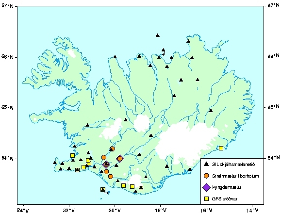
The
Physics Department of the Icelandic Meteorological
Office closely monitors seismic activity on the entire
island. There are stations set up near the volcanoes to
monitor any changes.
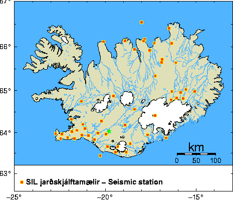
This map shows the
location of seismic stations across the country. I
have placed a green star at the location of Hekla.
30
The
Physics Department of the Icelandic Meteorological
Office also provides very up-to-date information about
earthquakes that have taken place within the last 24
hours. Monitoring the seismic activity and having a lot
of background information provides data that is useful
for comparisons. Geologists and Volcanologists have to
have some idea of what the background tectonic noise is
to be able to know when something significant is
happening. However, Soosalu writes, “Volcanic tremor
often begins prior to the actual surface outbreak of an
eruption and may extend beyond the duration of surface
activity. This was not the case at Hekla where the
tremor started at the same time as the eruption, and
also stopped simultaneously with the eruptive activity.
Thus, the tremor observations cannot be used for
predicting the Hekla eruptions” (p. 575). 28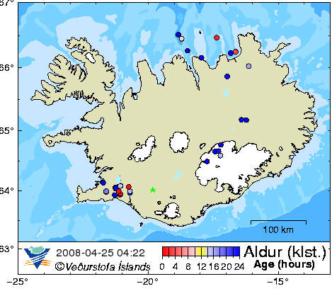
This map shows
earthquakes in Iceland from April 23, 2008 until April
25, 2008. The circles represent the location of
the earthquakes. The color of the circles
represent the time that has elapsed since the earthquake
has occurred. Red circles show the most recent
earthquakes, while the blue circles show earthquakes
that happened more than 24 hours ago.
This map shows the location of seismic
activity across the country. I have placed a green
star at the location of Hekla. 31
Because
seismicity is not as helpful at Hekla as it is at other
volcanoes, other factors, like strain and ground
deformation are also used. Ground deformation uses GPS
monitoring stations to determine changes in the crust
due to plate movement, volcanic activity and
earthquakes. Normally, preceding an eruption, the
crust swells with magma. After the eruption (or
during the eruption), the crust deflates again.
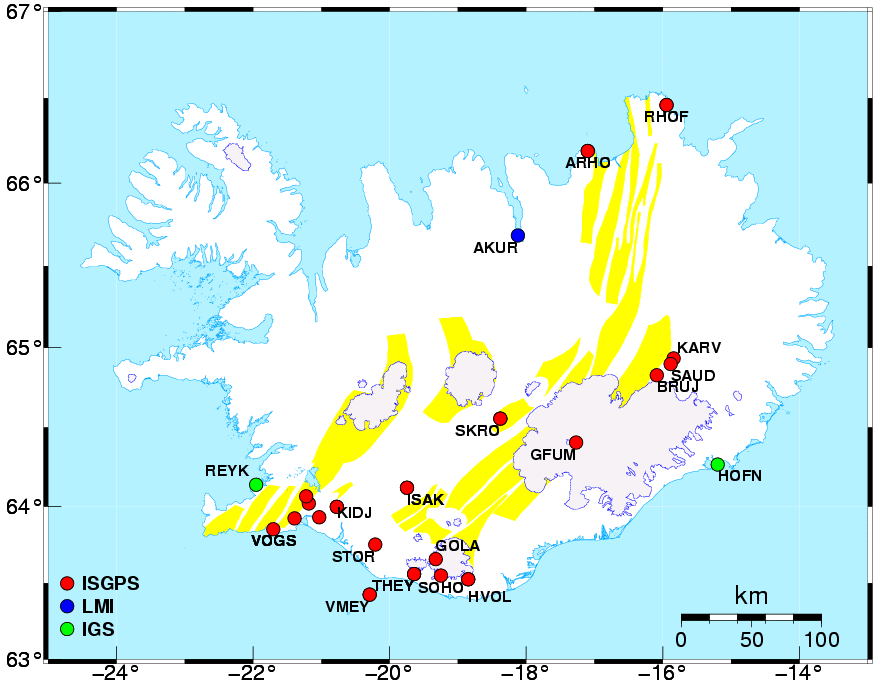
This map shows the location of all of the GPS monitoring
stations in Iceland. The station labeled ISAK is
the closest to Mt. Hekla.
32
The last method for monitoring Hekla’s activities includes
measuring strain on the surrounding bedrock. To detect
strain, boreholes are drilled to measure any changes in
the bedrock, including contractions, extensions and
volume changes. These changes can indicate the opening
and expansion of a conduit and the time when the conduit
reaches the surface. 33
Agust
Gudmundsson writes on the importance of stress,
“Similarly, the tensile stress concentration at Hekla
must have contributed to its unusually frequent
eruptions in the past three decades,” (p. 191).27
If stress is contributing to the eruptions at Hekla, it
is important to monitor stress to monitor the current
state of the volcano.
This map shows the location of the strain
meters in Iceland.33 |