|
Current Monitoring
Cotopaxi is intensely monitored by the Geophysical
Institute in Ecuador. Using spectograms, seismograms,
deformation monitors and geochemical monitors to measure
gas output and composition, all of which are located
around the volcano, they are able to detect any volcanic
activity.24 Based on its history of frequent
eruptions, many expect that it may begin to act up again
in the oncoming years.
In
the interest of alerting the public to the dangers that
Cotopaxi poses, the Geophysical Institute published a
summary of the types
of hazards an eruption could produce, and the damage
they could inflict on the surrounding area. It can be
found on their website.
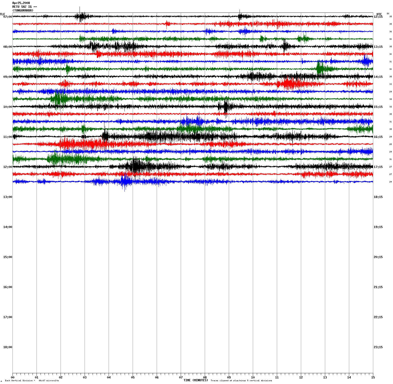
An example of the seismic readings taken daily at the Geophysical Institute. This reading was taken on the 23 of April, 2008. It indicates some seismic
activity within or around the volcano.
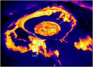
A thermal image of Cotopaxi's crater taken from the Geophysical Institute website.
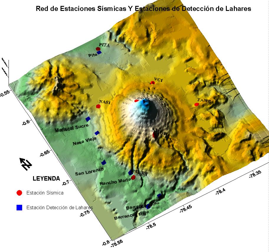
A  map of the seismic stations around Cotopaxi (the red dots). They have a total of seven seismometers in use currently, as well as seven lahar detection
 stations, which are the blue squares. Seismometers are used to detect any fluid or gas movement, as well as rock-breaking, all of which can be a sign
of an impending eruption.
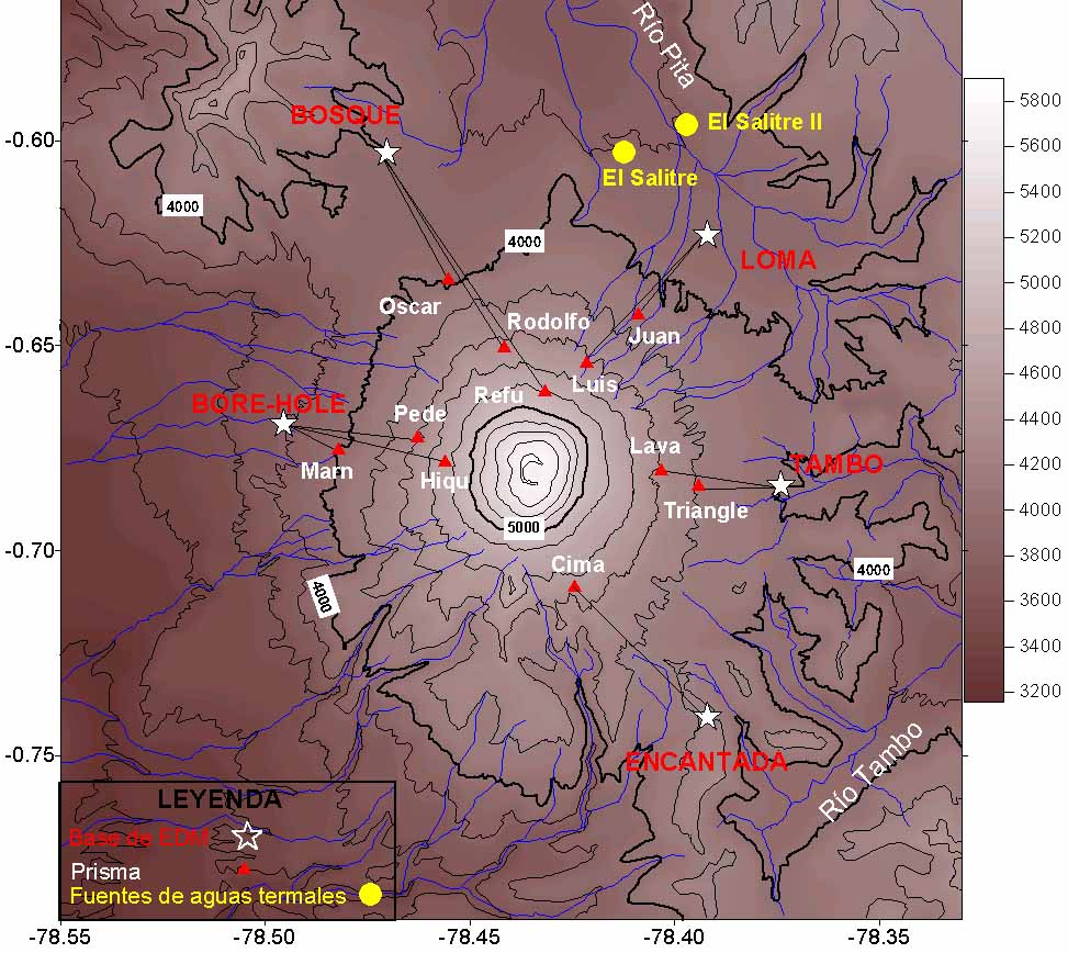
A map of Cotopaxi and its deformation monitors. These are used to measure any change in ground height as a result of the volcano bulging or expanding,
which could indicate a buildup of magma or gases within the volcano
All of this information, including the pictures, was taken from the Instituto Geofisico of Ecuador.24
|