|
|
Location
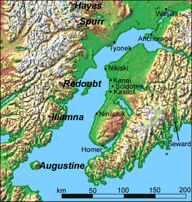
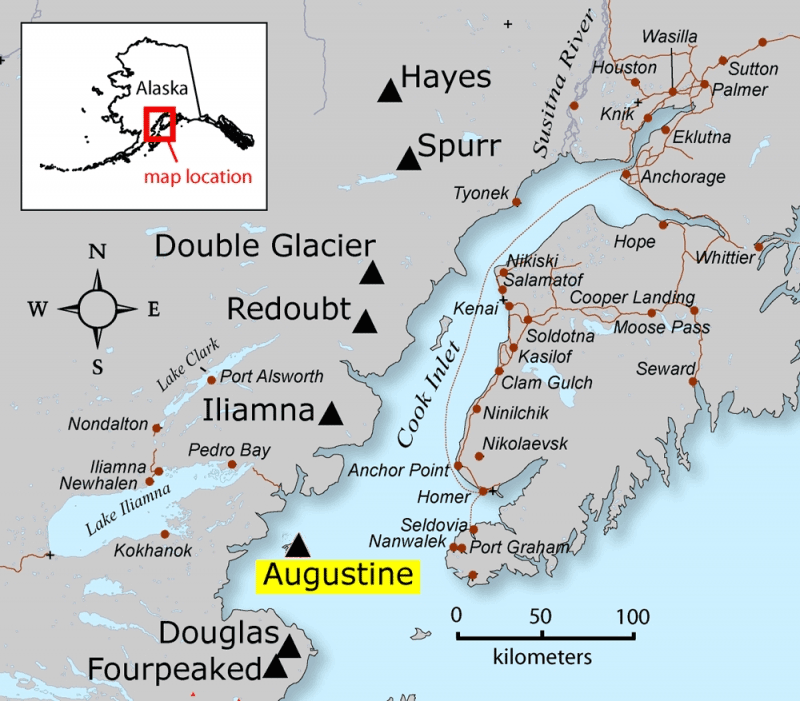
Augustine volcano is located in southwestern Alaska,
roughly 280 km southwest of Anchorage, on Augustine
Island, an island created almost entirely from the
volcano's deposits.2 The mountain rises out
of Kamishak Bay in the Cook Inlet, as can be see in the
maps below.1 The mountain is located within
300 km of more than half of Alaska's population,
including many small communities which can be seen in
the second map below.2
| Location1 |
Southwestern Alaska |
| Longitude1 |
153°26'0"
W |
| Latitude1 |
59°21'48" N |
| Elevation1 |
1252 m |

Map of Augustine Island, nearby towns and
other nearby volcanoes.
Fig. 2: Taken from
http://www.towerrocklodge.com/img/volcmap.gif

Map of Augustine Island, nearby towns and
other nearby volcanoes.
Fig. 3: Taken from
http://avo.alaska.edu/image.php?id=4830
Tectonic Setting
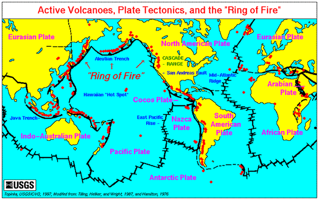
Mount Augustine is located in a chain of volcanic
islands running parallel to the Aleutian Trench, which
is itself located where the Pacific Plate is being
subducted under the North American Plate, at an area
called the Aleutian Megathrust.11 Subduction
occurs when one tectonic plate begins to descend beneath
the adjacent plate, causing the now lower plate to be
gradually "consumed."12 This descent creates
a large oceanic trench, in this case the Aleutian Trench
and, as the subducted rock melts, the magma created
rises upward, often forming a series of volcanic
islands, in this case the Aleutians.12

Global Plate Tectonics Map. Fig. 4: Taken
from
http://www.geog.nau.edu/courses/alew/ggr346/text/chapters/ch11.html
|