|
|
Disclaimer: This website has been created by a geology
student, not an expert; in no way should these hazard
maps be represented as or believed to have been officially produced.
(All maps created using Google Earth,
http://earth.google.com )
Hazards Augustine Island is
completely uninhabited. There are no permanent
structures on the island, and the closest human
settlements are nearly 20 kilometers away from the
shores of the volcanic island, thus the only real
threats posed to life are from ash fall, ash clouds
interfering with air travel, pumice rafts interfering
with sea travel and tsunamis that have historically been
caused by massive debris avalanches.3 In the event of an eruption, the best idea
would be for all nearby air and sea traffic to be
alerted as to the potential danger presented by the
volcano, and for authorities to ensure that the island
was itself evacuated of any visitors and scientists that
may happen to be on it at the time.
For all maps:
Red = HIGH DANGER
Yellow = MODERATE
DANGER
Green = LOW DANGER
Pyroclastic
Flows, Debris Avalanches, Directed Blasts and Lahars

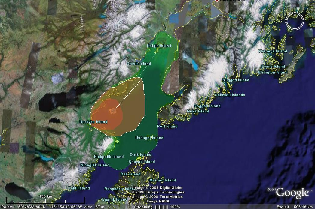
For most volcanoes, the greatest dangers posed to human
life come from pyroclastic flows, debris avalanches,
directed blasts and lahars. Augustine may be capable of
producing all of these volcanic phenomena, however no
settled humans would be faced with any sort of danger if
the mountain were to erupt in such a nature that one of
these hazards was produced.3 Most pyroclastic
flows are produced either by the collapse of an eruption
column or by the collapse of a lava dome. Debris
avalanches are created in much the same way, with the
structural failure of the extreme upper portion of the
mountain.3 In both prehistoric and
Holocene time, the majority of Augustine’s eruptions
have consisted of the collapse of its dome and the
eventual resurgence of the same dome, thus pyroclastic
flows and debris avalanches are common at Augustine.3
While flows and avalanches are common at the volcano,
they are unlikely to reach beyond the shores of the
island, and even if they were to do so, it would take an
eruption of almost unheard of strength to create a flow
powerful enough to traverse 20 kilometers of water, thus
the main threat would be to anyone who happened to be on
the island or who was in a boat very close to the
island.3 Lahars are produced when ash from an
eruption either lands in a body of water, creating
mudflows, or when ash is re-mobilized by rainwater. Due
to the high amount of ice and snow on Augustine Island,
the heat of an eruption will more likely than not create
a lot of melt water, with the ensuing ash fall creating
lahars that cover most of the island, as the island is
not particularly topographically varied.3
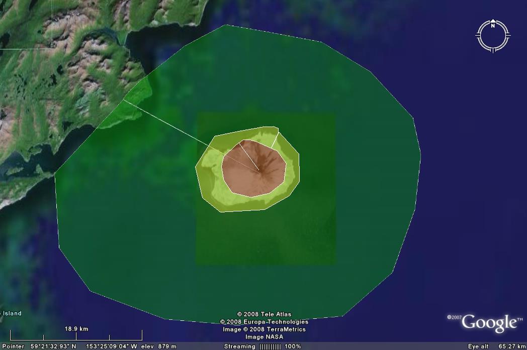
Directed blasts are lateral explosions that are caused
when there is a rapid releases of internal pressure on
the volcano, such as would be caused by a slope failure.3 The most
well known example of a directed blast is that created
by the eruption of Mount St. Helens in 1980. A directed
blast at Augustine is very unlikely – there has only
been one in the last 2500 years – thus the extent of the
green portion of the map is based upon a worst-case
scenario.3
Ash Fall and
Ash Clouds

When an eruption is powerful enough to fragment the
magma being erupted, ash is formed. This ash is thrown
into the air, creating a column of ash that can stretch
kilometers above the volcano into the atmosphere. The
ash that is at the top of the column can then be
transported by wind for thousands of kilometers.3
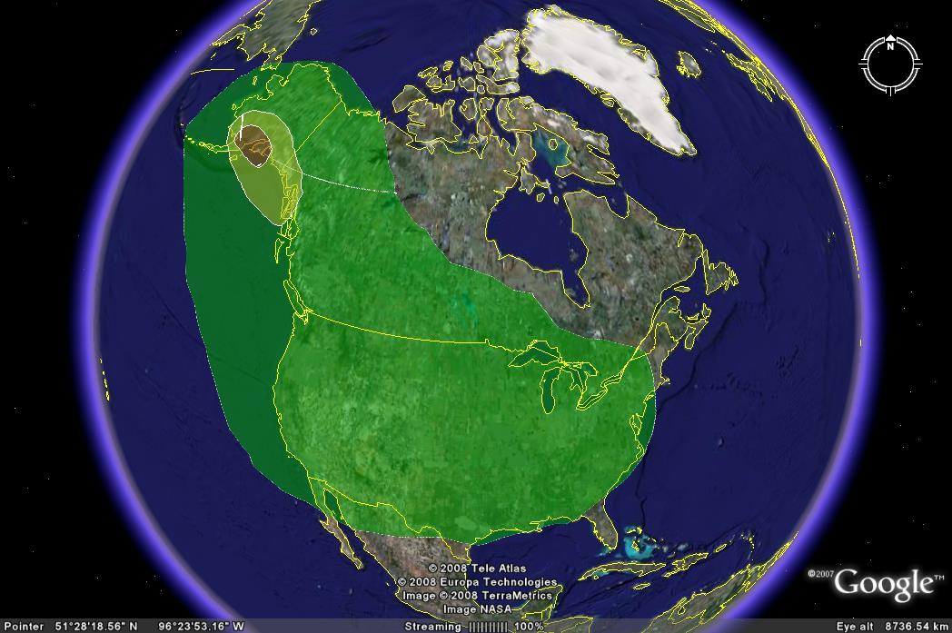
Given Augustine’s location at a crux for air travel to
Alaska, Russia and Japan, this ash is particularly
dangerous. While the greatest danger from ash to human
life is from the accumulation of ash that has fallen
from the column to the ground, as indicated by the red
and yellow areas on the map, Augustine also poses a
danger to all air travel in the area, and even some
thousands of kilometers away: in Augustine’s 1986
eruption, ash interfered with air travel as far away as
Arizona and Virginia.3
Pumice Rafts

Pumice rafts form when large-volume
pyroclastic flows enter the sea, allowing the erupted
pumice to form “rafts” that float on the surface of the
water.3 These rafts move with the water
current, and pose a large risk to any ships that happen
to be in the area, in this case the southern section of
Cook Inlet.3 Large rafts are capable of
staying afloat for weeks or even months, and were
reported in Augustine’s 1976 and 1986 eruptions.3
Tsunamis

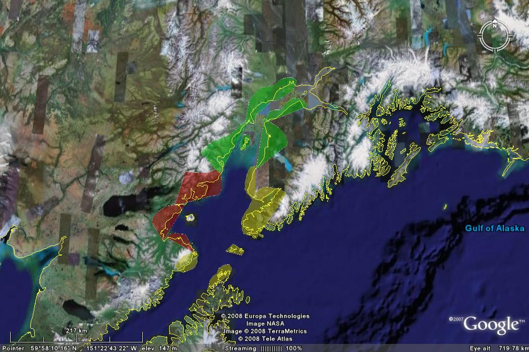
If a large enough debris avalanche was to enter the
water surrounding Augustine Island, it could disturb the
water enough to create tsunamis.3 The last
recorded tsunami caused by Augustine was in 1883,
however there is still a large risk posed by the threat
of a tsunami, enough so that, given the low population
density proximal to Augustine, tsunamis are the largest
threat to human life posed by Augustine.3 The
areas in the greatest danger would be those very close
to the island – the red areas that are within 30
kilometers of Augustine; the yellow areas are up to 100
kilometers away and the green areas are up to 300
kilometers away, but, given a powerful enough eruption,
these areas could still be threatened by tsunami waves.3
|