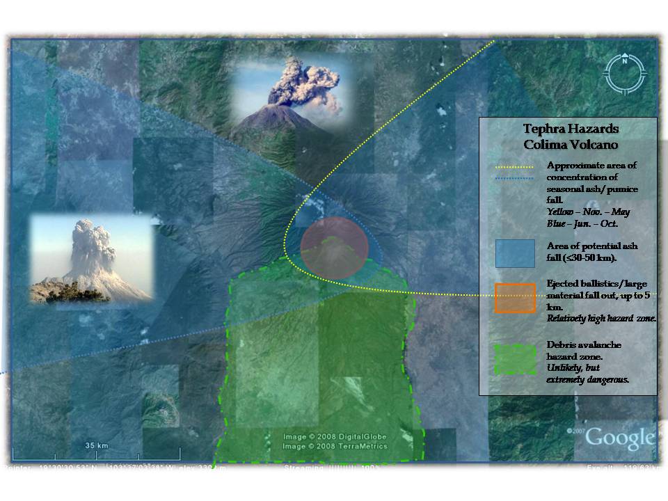
When I created
this hazard map, I drew largely on the
preexisting map released by the Observatorio
Vulcanológico18, especially in establishing the
seasonal wind direction affecting Colima. The
image of the eruption on the left (Fig.
4.2) is of Colima's May 2005 event
and the one at the top (Fig.
4.3) is "a typical view of a small
explosion at Colima" on 2/1/04.
Debris Avalanche –
A swift and unsorted mass of rock and soil
mobilized by gravity and unconfined by a channel
11, 15
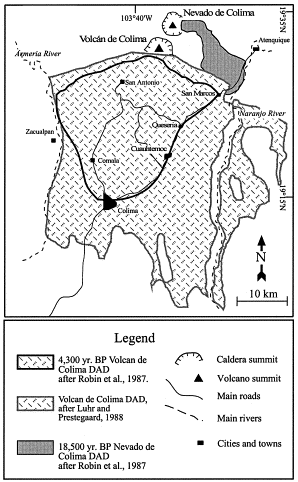
Fig.
4.1 - Map of previous debris
avalanches
Debris
Avalanches can be initialized in three ways
(seems to be the popular number)15:
1.
Magmatic eruptions
 2.
Non-magmatic explosions (it can happen, steam is
the cause here) 2.
Non-magmatic explosions (it can happen, steam is
the cause here)
3. "Cold,"
when the volcano simply can't support itself
anymore (i.e. sector collapses)
Seems
to be primary mechanism at Colima
Example
A
debris avalanche deposit at
Colima was discovered that is
believed to have extended up to
70 km from the vent,
covered an area of 1550
sq. km, and had a volume of
10 cubic km11.
Ash –
Fine particles formed in volcanic eruptions.14
This is kind of a simplistic definition, but
short of saying that it's the mountain and
material blown to bits, there is not a better
way to out it.
Ash is not
often a directly dangerous hazard, but rather an
inconvenience, and one that primarily produces
secondary consequences. Ash fall is capable of
complicating transportation, and irritating eyes
and lungs, but perhaps its most significant
consequence is in agriculture when it cloaks
crops and ruins grazing conditions.
The
biggest particles of ash and pumice (cooled,
bubbly lava) fall closest to the volcano, due to
gravity, and the quantity of ash diminishes as
distance from the vent increases. In addition,
because the wind direction is often variable and
the duration of the volcanic eruption is equally
erratic, ash may often fall in an uneven
distribution over the surrounding areas.
|