|
|
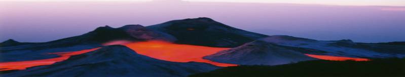
Monitoring at Ol Doinyo Lengai
Despite the fascination that
Ol Doinyo Lengai garners from locals and the volcanology
community alike, monitoring of this strange volcano
remains scarce. Most reports of volcanic activity are
merely eyewitness reports from locals, tourists, or
Tanzania National Park Service Officials.
No “systematic observations of active flows” began until
1960 because of the unpredictability and remoteness of
Ol Doinyo Lengai.
The Geological Survey of Tanzania, founded in 2005, is
currently compiling geological data about Tanzania, but
the Survey remains underfunded and the information
incomplete. The Geological Survey of Tanzania currently
operates five seismometers, one in Kibaya in the Arusha
region, approximately 60 kilometers from Ol Doinyo
Lengai.
Approximately 85% of Tanzania has been geologically
mapped, helping geologists gain a greater understanding
of the geological setting of the Great Rift Valley.
Despite these recent advancements, the monitoring of Ol
Doinyo Lengai is still dramatically underequipped and
underfunded.
Several volcanologists and
scholars maintain comprehensive sites monitoring
activity on Ol Doinyo Lengai. Compiling data from
expeditions to the volcano and information from locals,
Frederick Belton and Celia
Nyamweru maintain accurate websites pertaining to
eruptive activity at the volcano. The Smithsonian
Institute's Global Volcanism Program also follows
activity at Ol Doinyo Lengai, publishing monthly reports
and an eruptive history of the volcano. For access
to these sites, please go to the "Links" section of this
site.
|